3DEO and Aethon Aerial announce strategic partnership combining airborne operations & Geiger-mode lidar
Denver, CO – February 16, 2026 — Aethon Aerial and 3DEO today announced a strategic partnership to deliver next-generation 3DEO Geiger-mode lidar solutions for transmission, distribution, and corridor mapping as well as targeted collection of urban and rural distribution and sub-transmission infrastructure.
Sequoia™ Geiger-mode lidar platform and airborne expertise
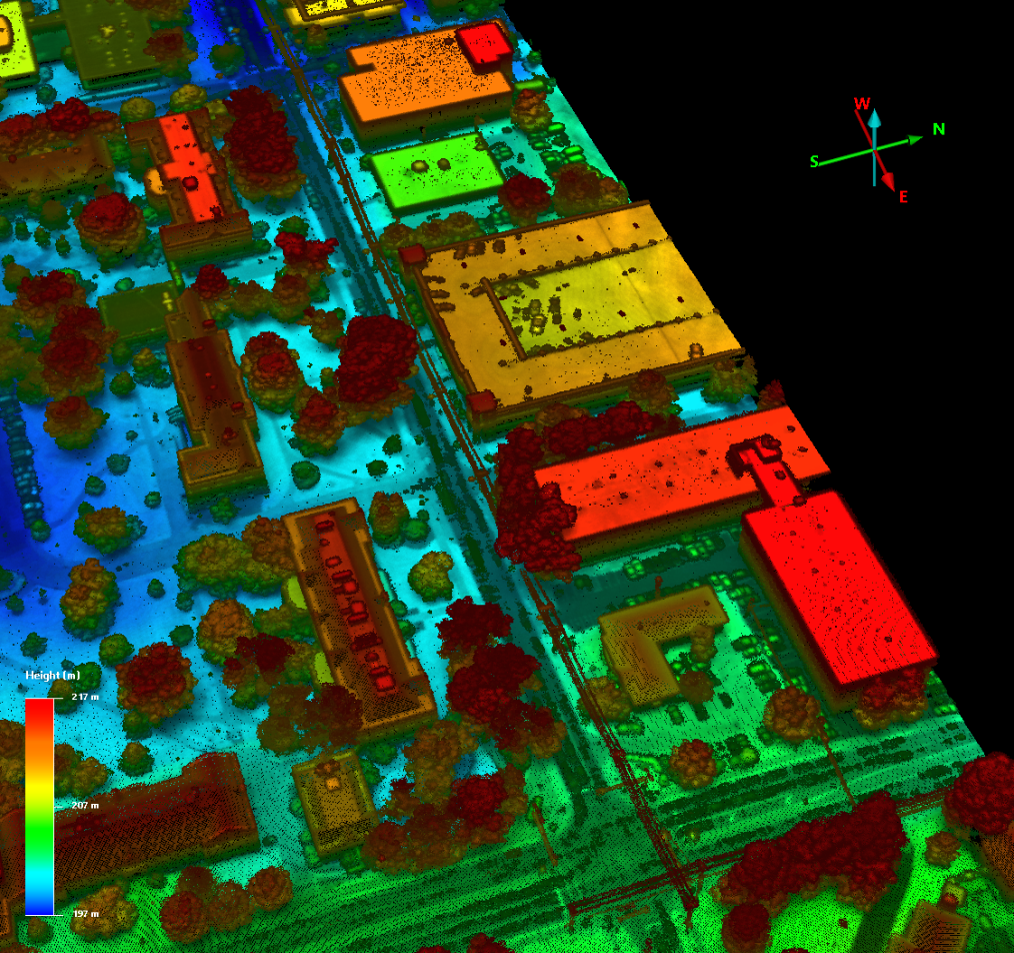
Unveiled at Geo Week 2026, the collaboration combines 3DEO’s Sequoia™ Geiger-mode lidar platform, optimized for high-altitude, long-range corridor collection, with Aethon Aerial’s proven expertise in airborne lidar operations, data processing, and utility-grade analytics.
Sequoia™ is purpose-built for wide-area transmission corridor mapping, enabling survey-grade point densities across hundreds or thousands of kilometers of right-of-way from higher altitudes and faster aircraft platforms. In addition, the system supports targeted, high-resolution collections for urban and rural distribution and sub-transmission networks, allowing utilities to selectively acquire dense data over constrained or high-risk areas without resorting to slow, low-altitude flight profiles.
“Sequoia was designed to solve the scale problem utilities face,” said Dale Fried, Founder and CEO of 3DEO. “It delivers the density needed for transmission corridors at speed and altitude, while still supporting focused collections over distribution networks where precision and selectivity matter most.”
“Utilities want network-wide visibility without sacrificing detail where it counts,” said Alastair Jenkins, Chairman and CEO of Aethon Aerial. “By pairing Sequoia’s high-altitude corridor capability with Aethon’s analytics and delivery platform, we can offer a single, coherent solution spanning transmission, sub-transmission, and distribution infrastructure.”
Under the proposed joint venture framework:
3DEO will provide Sequoia™ GM lidar systems, mission design support, and raw data processing into high-density 3D point clouds.
Aethon Aerial will lead customer engagement, flight operations coordination, advanced analytics, and delivery of utility-ready products including vegetation clearance, asset location verification, and engineering-grade outputs.
The parties expect to launch joint pilot programs with select utility customers in 2026 and to progress toward a formal joint venture entity following initial market validation.
About 3DEO
3DEO is a pioneer in next-generation Geiger-mode lidar systems. Its Sequoia™ platform enables high-density, long-range lidar acquisition optimized for wide-area and corridor-mapping applications, fundamentally improving the economics and scalability of infrastructure mapping. https://3deo.lidar.com
About Aethon Aerial
Aethon Aerial is a leading provider of airborne lidar, imaging, analytics, and utility intelligence solutions across North America. Aethon specializes in large-scale corridor mapping, vegetation management, asset verification, and engineering-grade geospatial products supporting grid reliability, wildfire risk mitigation, and regulatory compliance. www.aethonaerial.com
